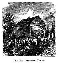
Old German & St. Peters Church
The Old German Church was located at the intersection of the former Ten Mile Creek Road and St. David's Road, near the south edge of the pondage area below the escarpment and east of the pump house. In the year 1773 The Old German Church was a log building, it was built by the Lutherans who were the first United Empire Loyalists that occupied the area and it was intended to serve the predominantly Lutheran and Presbyterian population in the area.
In 1802 one Jacob Ball Jr. gave a deed for a piece of land containing 5 acres, to be used forever as a burial ground next to the Old German Church.
This was Thorold's first cemetery.
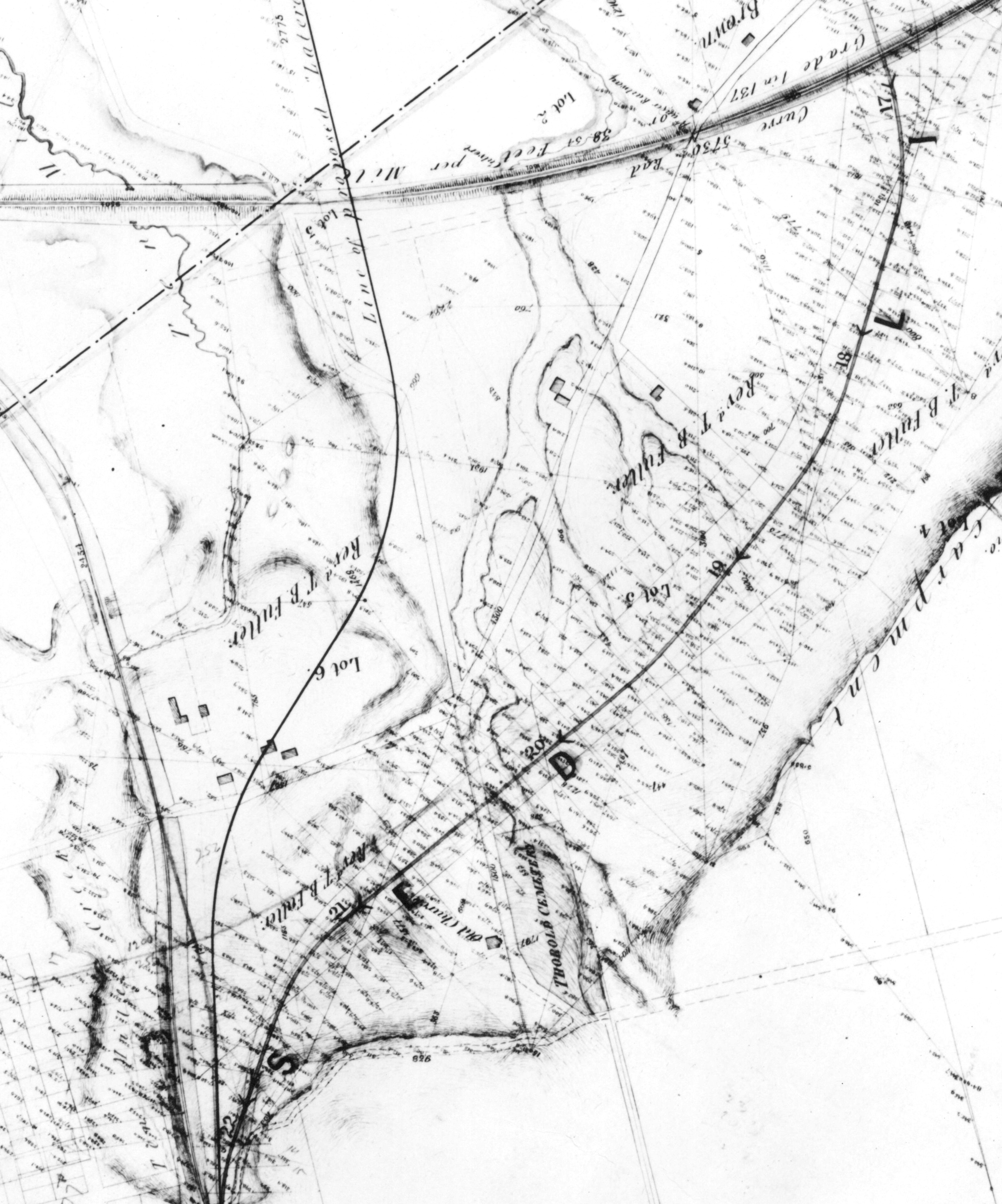
Below is a map from 1872 that clearly shows near the bottom "Old Church" and "Thorold Cemetery" This would be the Old German Chruch and the 5 acres of land that Jacob Ball Jr. Donated. You can click on the map for a larger version.
St. Peter's Anglican Church
In 1832, a new stone church was built on the site of the now demolished Old German Church and named St. Peters. By this time it had become an Anglican church. Thomas Brock Fuller became its first full-time priest. It was a typical country church. It's days were numbered, however, in that it was too small and too far removed from the rapidly growing village of Thorold. (developing along the 1st Welland Canal just west of Front Street).
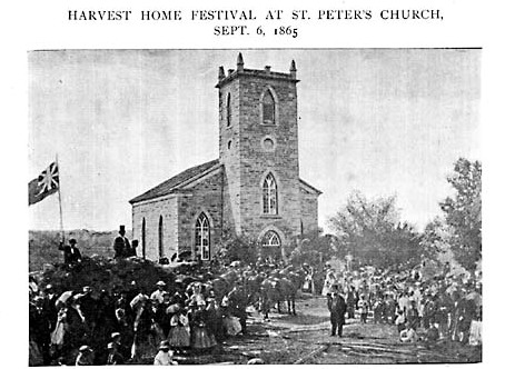
In 1856, St. Peter's was supplanted by the present church of St. John's in Thorold. St. Peter's was only used, after this, for funerals and special
services, such as the 1865 Harvest Festival shown in the picture below
In the mid-1870's, with construction of the Third Welland Canal proceeding alongside, St. Peter's was demolished. The old burying grounds was
increasingly neglected and was finally abandoned altogether in 1886 with the opening of Lakeview Cemetery. In 1923 the bodies in the old cemetery were removed and re-buried at Lakeview (those claimed at least!) to make way for a water-control pond for the flight locks. Only 250 graves were eventually relocated, leaving a total of 663 graves left unclaimed which are now submerged under the waters of the Seaway Pondage.
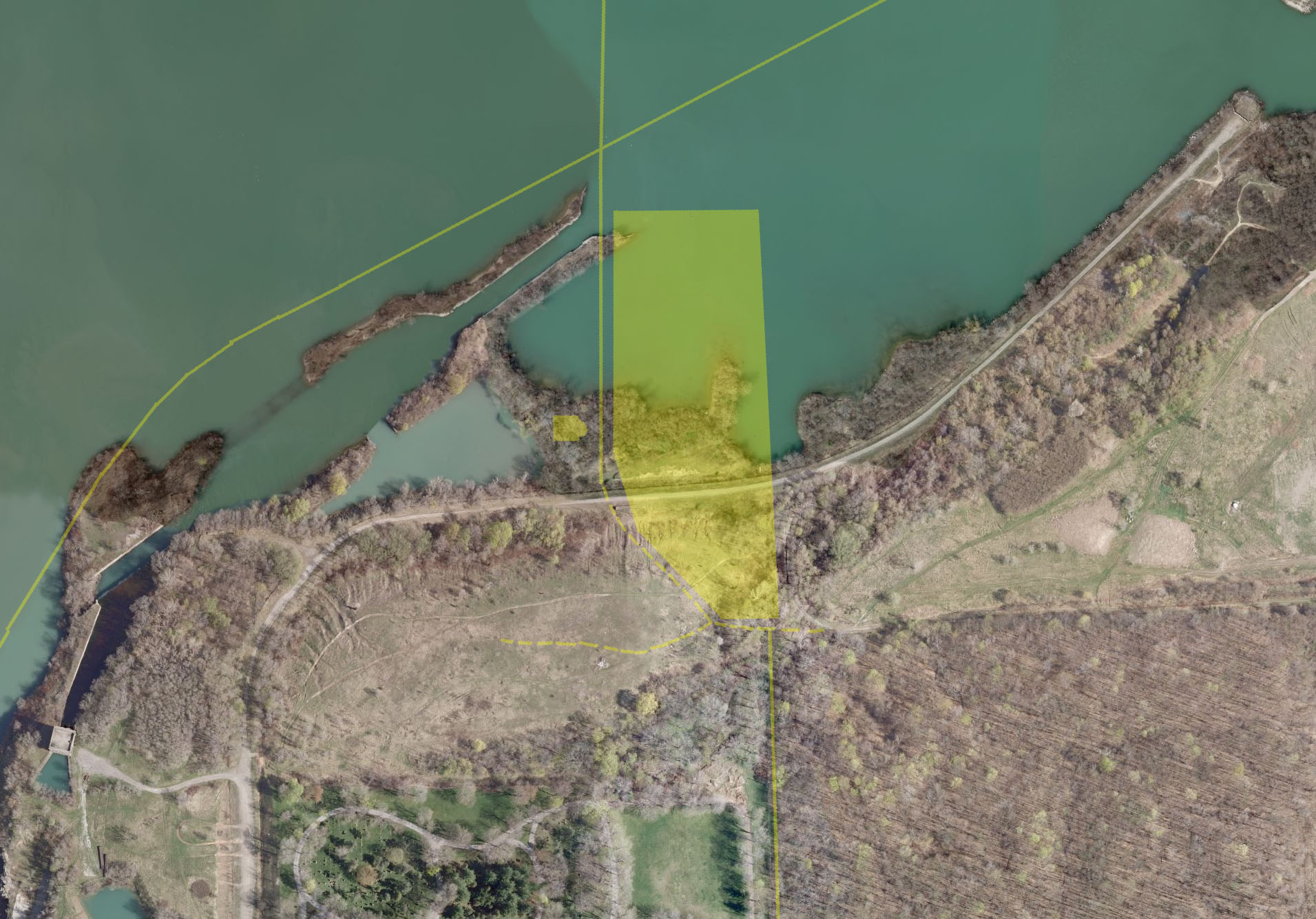
Originally, it was said that the churches and burial grounds were located North East of this location, this has now been proven incorrect.
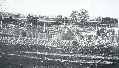
If you look below, you will see the yellow overlay. This was taken direclty from the 1872 map above and set to scale to match up with the roads. The small yellow square is the "Old Germn Church" and later St. Peters Church, and the large block of yellow is the 5 acres of land that was the cemetery donated by Jacob Ball Jr. Click the image below for the full size version.
Special thanks to:
Randy Barnes of the Thorold & Beaverdams Historical Society for historical data.
Matthew Jantz of "The Old Welland Canals" for his incredible maps and data.